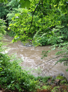
South River Fluvial Erosion Hazard Assessment Project

The Franklin Regional Council of Governments (FRCOG) secured funding from the Massachusetts Emergency Management Agency (MEMA) to conduct a Fluvial Erosion Hazard (FEH) risk assessment and mapping project for the South River Watershed. This project builds on the recent Fluvial Geomorphic and Habitat Assessment project, which was completed by FRCOG and Field Geology Services and funded by MassDEP.
Flooding is the most common natural hazard in Massachusetts and results in millions of dollars of damage each year. Flood damages occur due to inundation and fluvial erosion. In western Massachusetts, most flood damages are a consequence of fluvial erosion. The hilly terrain and narrow river valleys, high gradient streams, intense rainstorms, deep snows, and historic settlement patterns adjacent to the rivers all contribute to fluvial erosion. Flooding and fluvial erosion can result in significant economic losses and damage to infrastructure, homes and businesses, risks to public safety, and damage to agricultural lands and aquatic resources.
Fluvial Erosion Hazard (FEH) maps identify the location and intensity of fluvial erosion hazards, as well as the area needed by a river to maintain equilibrium. A town can use a FEH map to update their zoning and land use regulations to include provisions that mitigate fluvial erosion hazards and their impact on public safety, homes, businesses and infrastructure. Some fluvial erosion hazard mitigation activities can result in additional benefits like healthier rivers, enhanced recreational opportunities, improved aesthetics, and better wildlife habitat. A FEH study and associated mapping has several hazard mitigation benefits, including:
- Can be applied at a watershed scale
- Enhances public safety and minimizes economic losses due to floods
- Provides a municipal planning tool in the form of a FEH Overlay District
- Aids towns in implementing their Pre-Disaster Multi-Hazard Mitigation Plans
- Identifies transportation infrastructure (e.g., roads, bridges and culverts) management priorities
- Identifies river restoration projects and informs river corridor management planning
The Franklin Regional Council of Governments has hired Field Geology Services, Inc. to conduct this study. Field work has begun and will continue through November and December, weather permitting, so you may see the consultants wading in the river and near the river banks. The consultants may also need to cross private property to gain access to the river. If you own land along the South River or its tributaries, please contact the town if you have concerns about allowing the consultants to walk across your land to access the river. Many of you have already met Nic Miller and John Field from Field Geology Services so they will be familiar faces.
A Project Kick-off Meeting will be scheduled in early 2015 and notices will be posted on the towns’ websites, FRCOG’s website and in the local newspapers. If you’d like to have your name added to the project mailing list or you’d like further information about the project, please contact your Town Administrators or Kimberly Noake MacPhee, P.G., FRCOG Land Use and Natural Resources Program Manager, kmacphee@frcog.org or 413.774.3167 x130.